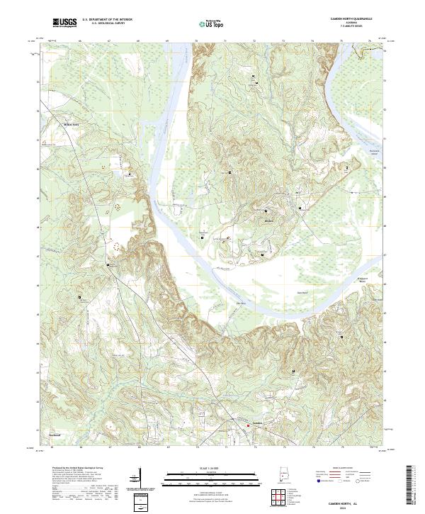
2024 Map of Camden North
USGS Topo · Published 2024About this map
The Alabama River carves a massive, winding path through this portion of Wilcox County, creating the distinctive geography of Gees Bend. This area is defined by its deep connection to the river, evidenced by historic crossings like the Gee's Bend Ferry and Ellis Ferry. The landscape is dotted with small settlements and numerous family and community burial grounds, including Pettway Cem, Hotel Cem, and Sodom Cem, which offer significant value for genealogical research in this rural Black Belt region. To the south, the county seat of Camden begins to develop near the Camden Byp, while the northern reaches remain dominated by the river's floodplain and large creeks such as Shell Creek and Foster Creek. The proximity of Millers Ferry and the varied terrain of Hurricane Island highlight the importance of water management and navigation in shaping the local economy and settlement patterns.
Find a feature on this map
74 named features on this map. Tap any name to fly to it.
Don’t see what you’re looking for? This feature index may not catch every label — zoom into the map to look around manually.
Map Details
Editions of this 2024 Camden North Map
This is the sole edition of this map. No revisions or reprints were ever made.
Other maps of this area

1953 · Montgomery
USGS Topo · 1:250,000

1953 · Andalusia
USGS Topo · 1:250,000

1956 · Montgomery
USGS Topo · 1:250,000

1957 · Montgomery
USGS Topo · 1:250,000

1957 · Andalusia
USGS Topo · 1:250,000

1957 · Carlowville
USGS Topo · 1:62,500

1973 · Coy
USGS Topo · 1:24,000

1973 · Camden South
USGS Topo · 1:24,000

1974 · Crumptonia
USGS Topo · 1:24,000

1974 · Catherine
USGS Topo · 1:24,000