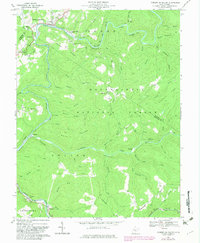
1966 Map of Camden On Gauley
USGS Topo · Published 1982About this map
The Gauley River and Cherry River converge in this mid-1960s portrait of a central West Virginia landscape defined by narrow valleys and industrial transition. Timber and coal interests are evident through the Ohio and Baltimore Railroad corridor and scattered infrastructure like the Strip Mine, Tipple, and Conveyor near Holcomb. The rugged interior is managed as part of the Monongahela National Forest, where features such as the Big Rock Campground and Woodbine Picnic Area contrast with the heavy industrial sites downstream. Community life is anchored by numerous small houses of worship, including Blacks Chapel and St Marys Ch, alongside family-named landmarks like Williams Cem and Russell Cem. These small settlements and cemeteries, scattered along the winding ridges and runs, provide a detailed look at the rural social geography before late-20th-century shifts.
Find a feature on this map
65 named features on this map. Tap any name to fly to it.
Don’t see what you’re looking for? This feature index may not catch every label — zoom into the map to look around manually.
Map Details
Editions of this 1966 Camden On Gauley Map
3 editions found
Other maps of this area

1889 · Nicholas
USGS Topo · 1:125,000

1891 · Nicholas
USGS Topo · 1:125,000

1891 · Huntersville
USGS Topo · 1:125,000

1894 · Huntersville
USGS Topo · 1:125,000

1901 · Nicholas
USGS Topo · 1:125,000

1915 · Webster Springs
USGS Topo · 1:48,000

1915 · Cowen
USGS Topo · 1:48,000

1917 · Cowen
USGS Topo · 1:62,500

1918 · Webster Springs
USGS Topo · 1:62,500

1918 · Richwood
USGS Topo · 1:62,500