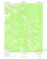
1966 Map of Camden on Gauley
USGS Topo · Published 1977About this map
Camden on Gauley and Gauley Mills serve as the primary hubs along the northern bend of the Gauley River in this mid-1960s survey. The landscape is defined by the industrial and transport infrastructure of the Baltimore and Ohio Railroad, which follows the river's winding path through the Monongahela National Forest. Evidence of the region's timber and coal economy is visible at Holcomb and the nearby Strip Mine Tipple, while smaller settlements like Allingdale and Curtin appear along the rail lines.
Find a feature on this map
76 named features on this map. Tap any name to fly to it.
Don’t see what you’re looking for? This feature index may not catch every label — zoom into the map to look around manually.
Map Details
Editions of this 1966 Camden on Gauley Map
3 editions found
Other maps of this area

1889 · Nicholas
USGS Topo · 1:125,000

1891 · Nicholas
USGS Topo · 1:125,000

1891 · Huntersville
USGS Topo · 1:125,000

1894 · Huntersville
USGS Topo · 1:125,000

1901 · Nicholas
USGS Topo · 1:125,000

1915 · Webster Springs
USGS Topo · 1:48,000

1915 · Cowen
USGS Topo · 1:48,000

1917 · Cowen
USGS Topo · 1:62,500

1918 · Webster Springs
USGS Topo · 1:62,500

1918 · Richwood
USGS Topo · 1:62,500