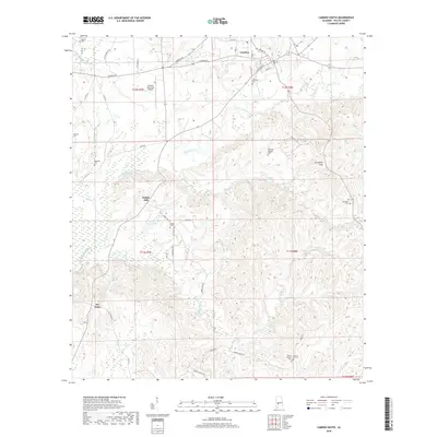
2018 Map of Camden South
USGS Topo · Published 2018About this map
Camden, the county seat of Wilcox County, anchors the northern edge of this landscape, where the town grid meets the rolling topography of southwest Alabama. The area is defined by a dense network of country roads and family-named landmarks, reflecting a long-established rural settlement pattern centered on agricultural and timber lands. To the south, the terrain becomes increasingly complex around Pebble Hill and the Grumpton Hills, drained by numerous watercourses including Pursley Cr, Gravel Cr, and Bones Br. Genealogists and local historians will find significant value in the high concentration of burial sites scattered across the township lines, such as Mcintosh Cem, Wheeler Quarter Cem, and the dual location of Mount Carmel Cem and Gravel Hill Cem in the southeast corner. The presence of Dry Forks and the Camden Municipal Airport further illustrates the intersection of small-town commerce and rural industry.
Find a feature on this map
53 named features on this map. Tap any name to fly to it.
Don’t see what you’re looking for? This feature index may not catch every label — zoom into the map to look around manually.
Map Details
Editions of this 2018 Camden South Map
This is the sole edition of this map. No revisions or reprints were ever made.
Other maps of this area

1953 · Montgomery
USGS Topo · 1:250,000

1953 · Andalusia
USGS Topo · 1:250,000

1956 · Montgomery
USGS Topo · 1:250,000

1957 · Montgomery
USGS Topo · 1:250,000

1957 · Andalusia
USGS Topo · 1:250,000

1957 · Carlowville
USGS Topo · 1:62,500

1973 · Coy
USGS Topo · 1:24,000

1973 · Hybart
USGS Topo · 1:24,000

1973 · Camden South
USGS Topo · 1:24,000

1973 · Vredenburgh
USGS Topo · 1:24,000