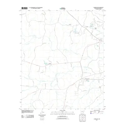
2011 Map of Camden SW
USGS Topo · Published 2011About this map
Lewis Bayou and North Bayou dominate the drainage patterns of this Ouachita County landscape, where the terrain is marked by a series of small, private impoundments and rural cemeteries. The area's water management is evident in the presence of several named dams, including Greenings Lake Dam and Darby Lake Dam, which create significant local water bodies like Greenings Lake and Lake Darby. For those researching family history, the map provides precise locations for Eternal Rest Cemetery, Hawkins Cemetery, Pleasant Hill Cemetery, and Mount Olive Cemetery, which are scattered among a network of county roads including Quachita Rd 56 and County Rd 171. The drainage of Ross Creek and South Bayou further characterizes the low-lying hydrology typical of this part of southern Arkansas.
Find a feature on this map
69 named features on this map. Tap any name to fly to it.
Don’t see what you’re looking for? This feature index may not catch every label — zoom into the map to look around manually.
Map Details
Editions of this 2011 Camden SW Map
This is the sole edition of this map. No revisions or reprints were ever made.
Other maps of this area

1901 · Gurdon
USGS Topo · 1:125,000

1903 · Camden
USGS Topo · 1:125,000

1951 · Camden
USGS Topo · 1:24,000

1953 · El Dorado
USGS Topo · 1:250,000

1957 · El Dorado
USGS Topo · 1:250,000

1958 · El Dorado
USGS Topo · 1:250,000

1960 · El Dorado
USGS Topo · 1:250,000

1962 · Louann
USGS Topo · 1:24,000

1962 · Buena Vista
USGS Topo · 1:24,000

1964 · Louann
USGS Topo · 1:62,500