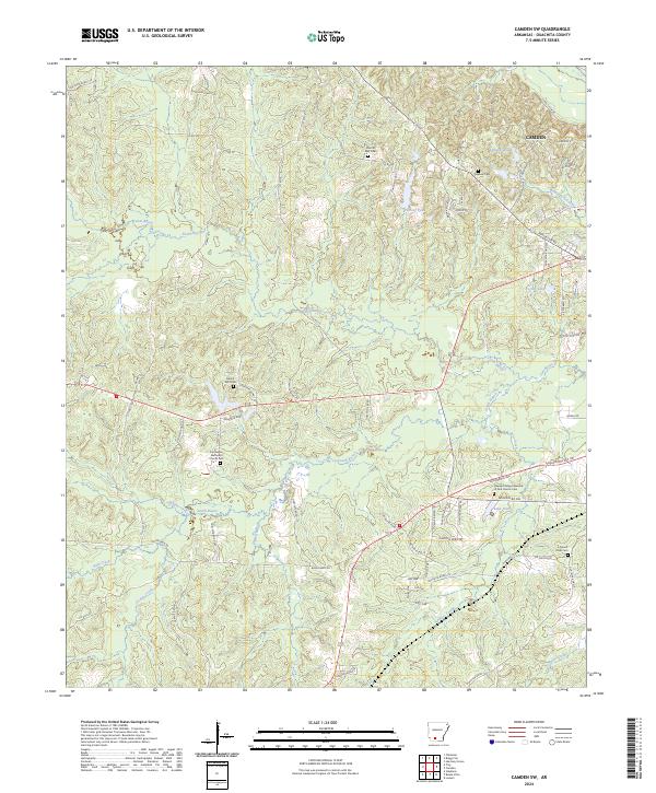
2024 Map of Camden SW
USGS Topo · Published 2024About this map
The southwestern reaches of Camden transition into a landscape defined by an intricate network of drainage, where the South Bayou and North Bayou converge toward the main channel of Two Bayou. This 2024 survey documents a rural topography scattered with established local institutions, including the Two Bayou Methodist Church and its accompanying Two Bayou Methodist Church Cem. The terrain rises toward locally prominent elevations such as Mount Zion, which serves as a focal point for the Mount Zion Church and Mount Zion Cem. This map is particularly useful for genealogical research, locating several smaller burial grounds like the Eternal Rest Cem and Hawkins Cem. The southern portion of the quadrangle is marked by landmarks like Lake Darby and the Pleasant Ridge Assembly of God Church, illustrating the distribution of community centers across the Ouachita County countryside.
Find a feature on this map
83 named features on this map. Tap any name to fly to it.
Don’t see what you’re looking for? This feature index may not catch every label — zoom into the map to look around manually.
Map Details
Editions of this 2024 Camden SW Map
This is the sole edition of this map. No revisions or reprints were ever made.
Other maps of this area

1901 · Gurdon
USGS Topo · 1:125,000

1903 · Camden
USGS Topo · 1:125,000

1951 · Camden
USGS Topo · 1:24,000

1953 · El Dorado
USGS Topo · 1:250,000

1957 · El Dorado
USGS Topo · 1:250,000

1958 · El Dorado
USGS Topo · 1:250,000

1960 · El Dorado
USGS Topo · 1:250,000

1962 · Louann
USGS Topo · 1:24,000

1962 · Buena Vista
USGS Topo · 1:24,000

1964 · Louann
USGS Topo · 1:62,500