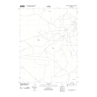
2011 Map of Camels Back Ridge NE
USGS Topo · Published 2011About this map
Dugway and the nearby Fox Area anchor this Tooele County survey, which documents the remote terrain south of the Great Salt Lake during the early 21st century. The map depicts a sparse network of desert roads, including Stark Rd and Simpson Springs Rd, threading between prominent geological features. The landscape is defined by the southern reaches of the Cedar Mountains and a series of isolated peaks such as Little Granite Mountain, Little Davis Mountain, and Davis Mountain. In the southwest corner, the drainage of Government Creek provides the primary hydrological feature in this arid environment. The layout of modern facilities and the surrounding Flat Hills reflect the unique land use of this region, serving as a valuable record for those studying the development and topography of Utah's West Desert.
Find a feature on this map
10 named features on this map. Tap any name to fly to it.
Don’t see what you’re looking for? This feature index may not catch every label — zoom into the map to look around manually.
Map Details
Editions of this 2011 Camels Back Ridge NE Map
This is the sole edition of this map. No revisions or reprints were ever made.
Other maps of this area

1885 · Tooele Valley
USGS Topo · 1:250,000

1953 · Tooele
USGS Topo · 1:250,000

1954 · Camels Back Ridge NW
USGS Topo · 1:24,000

1955 · Tabbys Peak SE
USGS Topo · 1:24,000

1955 · Camels Back Ridge SW
USGS Topo · 1:24,000

1955 · Simpson Springs
USGS Topo · 1:24,000

1955 · Indian Peaks
USGS Topo · 1:24,000

1955 · Camels Back Ridge NE
USGS Topo · 1:24,000

1955 · Davis Knolls
USGS Topo · 1:24,000

1955 · Deseret Peak
USGS Topo · 1:62,500