
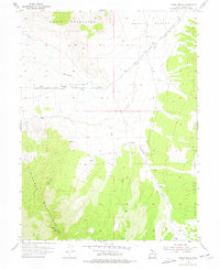
1955 Map of Indian Peaks
USGS Topo · Published 1956About this map
The Simpson Route of Pony Express traces a historical line through this arid basin in Tooele County, marking the path where riders once crossed between the Davis Mountains and the Simpson Mountains. The landscape transitions from the flat expanses of Skull Valley into the high elevations of Indian Peaks, which rise within the western reaches of the Wasatch National Forest.
Find a feature on this map
12 named features on this map. Tap any name to fly to it.
Don’t see what you’re looking for? This feature index may not catch every label — zoom into the map to look around manually.
Map Details
Editions of this 1955 Indian Peaks Map
2 editions found
Other maps of this area

1885 · Sevier Desert
USGS Topo · 1:250,000

1885 · Tooele Valley
USGS Topo · 1:250,000

1953 · Tooele
USGS Topo · 1:250,000

1953 · Delta
USGS Topo · 1:250,000

1955 · Simpson Springs
USGS Topo · 1:24,000

1955 · Indian Springs
USGS Topo · 1:24,000

1955 · Camels Back Ridge NE
USGS Topo · 1:24,000

1955 · Davis Knolls
USGS Topo · 1:24,000

1955 · Coyote Springs
USGS Topo · 1:24,000

1955 · Tooele
USGS Topo · 1:250,000