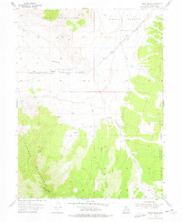
1955 Map of Indian Peaks
USGS Topo · Published 1977About this map
Davis Mountains and the Simpson Mountains dominate this high-desert landscape in Tooele County, where 1950s surveying work documented a sparsely settled territory of ranching and historical transit. The map centers on the high desert flats of Skull Valley, showing the James Ranch as the primary human settlement. The drainage patterns of Government Creek and Lee Creek define the topography between the peaks, leading toward the northern valley floor.
Find a feature on this map
13 named features on this map. Tap any name to fly to it.
Don’t see what you’re looking for? This feature index may not catch every label — zoom into the map to look around manually.
Map Details
Editions of this 1955 Indian Peaks Map
2 editions found
Other maps of this area

1885 · Sevier Desert
USGS Topo · 1:250,000

1885 · Tooele Valley
USGS Topo · 1:250,000

1953 · Tooele
USGS Topo · 1:250,000

1953 · Delta
USGS Topo · 1:250,000

1955 · Simpson Springs
USGS Topo · 1:24,000

1955 · Indian Peaks
USGS Topo · 1:24,000

1955 · Indian Springs
USGS Topo · 1:24,000

1955 · Camels Back Ridge NE
USGS Topo · 1:24,000

1955 · Davis Knolls
USGS Topo · 1:24,000

1955 · Coyote Springs
USGS Topo · 1:24,000