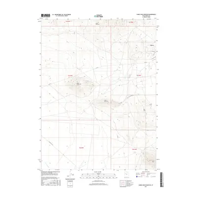
2017 Map of Camels Back Ridge NE
USGS Topo · Published 2017About this map
The Dugway settlement occupies the northeastern corner of this modern topographic record, where residential streets like W Knight Ave and Doolittle Ave meet the open expanse of the Utah desert. This 2017 survey details a landscape dominated by prominent rises including Little Granite Mtn, Little Davis Mtn, and the southern reach of the Cedar Mountains. The terrain is characterized by large, empty basins bisected by utility-oriented road networks such as Stark Rd and Simpson Springs Rd. In the south, the ephemeral drainage of Government Cr winds through the flats near Davis Mtn, illustrating the sparse water resources and strategic isolation of this region within Tooele County. The map provides a clear look at the logistical layout of the area surrounding the military installation, showing the transition from structured residential blocks to the open Flat Hills.
Find a feature on this map
19 named features on this map. Tap any name to fly to it.
Don’t see what you’re looking for? This feature index may not catch every label — zoom into the map to look around manually.
Map Details
Editions of this 2017 Camels Back Ridge NE Map
This is the sole edition of this map. No revisions or reprints were ever made.
Other maps of this area

1885 · Tooele Valley
USGS Topo · 1:250,000

1953 · Tooele
USGS Topo · 1:250,000

1954 · Camels Back Ridge NW
USGS Topo · 1:24,000

1955 · Tabbys Peak SE
USGS Topo · 1:24,000

1955 · Camels Back Ridge SW
USGS Topo · 1:24,000

1955 · Simpson Springs
USGS Topo · 1:24,000

1955 · Indian Peaks
USGS Topo · 1:24,000

1955 · Camels Back Ridge NE
USGS Topo · 1:24,000

1955 · Davis Knolls
USGS Topo · 1:24,000

1955 · Deseret Peak
USGS Topo · 1:62,500