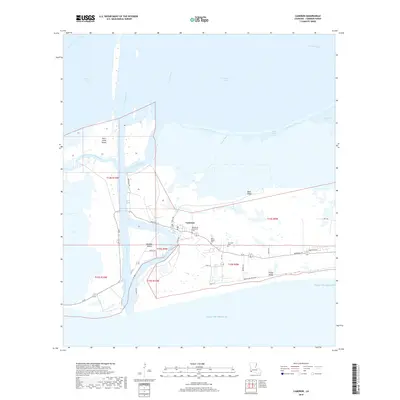
2018 Map of Cameron
USGS Topo · Published 2018About this map
Cameron sits at the critical junction where the Calcasieu River meets the Gulf of Mexico, serving as a vital coastal hub for maritime and local transit. The town's layout is shaped by its proximity to the Calcasieu Ship Channel and the convergence of West Fork Calcasieu Pass and East Fork Calcasieu Pass. This 2018 survey illustrates the local topography of ridges and marshes, notably Back Ridge and Front Ridge, which provide a contrast to the surrounding wetlands and the waters of Calcasieu Lake.
Find a feature on this map
41 named features on this map. Tap any name to fly to it.
Don’t see what you’re looking for? This feature index may not catch every label — zoom into the map to look around manually.
Map Details
Editions of this 2018 Cameron Map
This is the sole edition of this map. No revisions or reprints were ever made.
Other maps of this area

1934 · Cameron
USGS Topo · 1:24,000

1934 · Holly Beach
USGS Topo · 1:24,000

1934 · Sweet Lake
USGS Topo · 1:24,000

1934 · Browns Lake
USGS Topo · 1:24,000

1934 · Grand Bayou
USGS Topo · 1:24,000

1935 · Cameron
USGS Topo · 1:31,680

1935 · Sweet Lake
USGS Topo · 1:31,680

1935 · Hackberry
USGS Topo · 1:31,680

1935 · Holly Beach
USGS Topo · 1:31,680

1935 · Grand Bayou
USGS Topo · 1:31,680