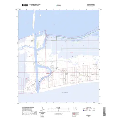
2024 Map of Cameron
USGS Topo · Published 2024About this map
Cameron serves as the focal point of this coastal landscape, situated where the Calcasieu Ship Channel meets the Gulf of Mexico. The town's civic life is anchored by the Cameron Parish Courthouse, while its history is preserved at Wakefield Memorial Cem and the Our Lady Star of the Sea Cem. The geography is defined by narrow ridges and expansive marshlands, including the Cameron Prairie National Wildlife Refuge to the north and the landforms of Back Ridge and Front Ridge that run parallel to the coast.
Find a feature on this map
41 named features on this map. Tap any name to fly to it.
Don’t see what you’re looking for? This feature index may not catch every label — zoom into the map to look around manually.
Map Details
Editions of this 2024 Cameron Map
This is the sole edition of this map. No revisions or reprints were ever made.
Other maps of this area

1934 · Cameron
USGS Topo · 1:24,000

1934 · Holly Beach
USGS Topo · 1:24,000

1934 · Sweet Lake
USGS Topo · 1:24,000

1934 · Browns Lake
USGS Topo · 1:24,000

1934 · Grand Bayou
USGS Topo · 1:24,000

1935 · Cameron
USGS Topo · 1:31,680

1935 · Sweet Lake
USGS Topo · 1:31,680

1935 · Hackberry
USGS Topo · 1:31,680

1935 · Holly Beach
USGS Topo · 1:31,680

1935 · Grand Bayou
USGS Topo · 1:31,680