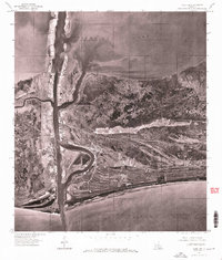
1960 Map of Cameron
USGS Topo · Published 1976About this map
Cameron stands at the strategic junction where the coastal marshlands meet the open water, serving as a critical gateway between the inland waters and the sea. This orthophotoquad, derived from 1975 aerial photography, reveals the intricate relationship between the settlement and the surrounding aquatic landscape. The town is flanked by the expansive Calcasieu Lake to the north and the deep reach of Calcasieu Pass to the west, which provides a direct corridor into the Gulf of Mexico.
Find a feature on this map
4 named features on this map. Tap any name to fly to it.
Don’t see what you’re looking for? This feature index may not catch every label — zoom into the map to look around manually.
Map Details
Editions of this 1960 Cameron Map
This is the sole edition of this map. No revisions or reprints were ever made.
Other maps of this area

1934 · Cameron
USGS Topo · 1:24,000

1934 · Holly Beach
USGS Topo · 1:24,000

1934 · Sweet Lake
USGS Topo · 1:24,000

1934 · Browns Lake
USGS Topo · 1:24,000

1934 · Grand Bayou
USGS Topo · 1:24,000

1935 · Cameron
USGS Topo · 1:31,680

1935 · Sweet Lake
USGS Topo · 1:31,680

1935 · Hackberry
USGS Topo · 1:31,680

1935 · Holly Beach
USGS Topo · 1:31,680

1935 · Grand Bayou
USGS Topo · 1:31,680