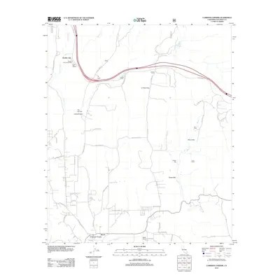
2012 Map of Cameron Corners
USGS Topo · Published 2012About this map
Barrett and Cameron Corners anchor the southern edge of this San Diego County quadrangle, situated where Campo Cr meets the local road network. The landscape is defined by its valleys and flats, most notably La Posta Valley and Miller Valley, which served as historical conduits for movement through the region. Interstate 8 cuts across the northern half of the map, following a path near the traditional Old Hwy 80 and passing through Boulder Oaks. The map details a mix of rural infrastructure and natural features, from the Boulder Oaks Campground to the extractive industrial site at Clover Flat Pit. Numerous truck trails and named local roads like Buckman Springs Rd and La Posta Rd spiderweb across the terrain, indicating a history of ranching and utility access in this mountainous area.
Find a feature on this map
50 named features on this map. Tap any name to fly to it.
Don’t see what you’re looking for? This feature index may not catch every label — zoom into the map to look around manually.
Map Details
Editions of this 2012 Cameron Corners Map
This is the sole edition of this map. No revisions or reprints were ever made.
Other maps of this area

1903 · Cuyamaca
USGS Topo · 1:125,000

1904 · Southern California Sheet No. 2
USGS Topo · 1:250,000

1931 · Carrizo
USGS Topo · 1:125,000

1939 · Campo
USGS Topo · 1:62,500

1942 · Potrero
USGS Topo · 1:48,000

1942 · Campo
USGS Topo · 1:62,500

1942 · Cuyapaipe
USGS Topo · 1:62,500

1942 · Cuyamaca Peak
USGS Topo · 1:62,500

1944 · Potrero
USGS Topo · 1:62,500

1944 · Cuyamaca Peak
USGS Topo · 1:62,500