
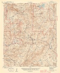
1944 Map of Cuyamaca Peak
USGS Topo · Published 1944About this map
Cuyamaca State Park and the surrounding Laguna Mountains are mapped here during the early 1940s, revealing a landscape defined by ranching, mountain schools, and indigenous lands. Several reservations are clearly delineated, including the Viejas Indian Reservation and Capitan Grande Indian Reservation, while the high country features the Cuyamaca Lodge near the Cuyamaca Reservoir. The map illustrates the transition from high-elevation peaks like Cuyamaca Pk to deep canyons and valleys.
Find a feature on this map
56 named features on this map. Tap any name to fly to it.
Don’t see what you’re looking for? This feature index may not catch every label — zoom into the map to look around manually.
Map Details
Editions of this 1944 Cuyamaca Peak Map
2 editions found
Other maps of this area

1893 · El Cajon
USGS Topo · 1:62,500

1901 · Elcajon
USGS Topo · 1:62,500

1903 · Cuyamaca
USGS Topo · 1:125,000

1903 · Elcajon
USGS Topo · 1:62,500

1903 · Ramona
USGS Topo · 1:125,000

1904 · Southern California Sheet No. 2
USGS Topo · 1:250,000

1931 · Vallecito
USGS Topo · 1:125,000

1931 · Carrizo
USGS Topo · 1:125,000

1939 · El Cajon
USGS Topo · 1:62,500

1939 · Campo
USGS Topo · 1:62,500