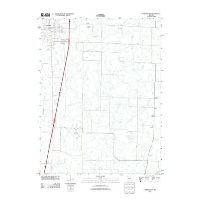
2012 Map of Cameron East
USGS Topo · Published 2012About this map
Cameron serves as the focal point for this rural landscape, which is defined by a dense network of cemeteries and small-scale water bodies. Several burial grounds, including Evergreen Cemetery, Graceland Cemetery, and Packard Cemetery, are concentrated near the town, while family or community sites like McDaniel Cemetery, Hill Cemetery, and Paxton Cemetery are distributed across the agricultural interior. This pattern provides a clear view of the area's social geography and genealogy, anchoring established rural settlements such as Kerr and Far West to the land.
Find a feature on this map
62 named features on this map. Tap any name to fly to it.
Don’t see what you’re looking for? This feature index may not catch every label — zoom into the map to look around manually.
Map Details
Editions of this 2012 Cameron East Map
This is the sole edition of this map. No revisions or reprints were ever made.
Other maps of this area

1923 · Maysville
USGS Topo · 1:62,500

1924 · Polo
USGS Topo · 1:62,500

1924 · Winston
USGS Topo · 1:62,500

1925 · Plattsburg
USGS Topo · 1:62,500

1925 · Maysville
USGS Topo · 1:62,500

1950 · Kansas City
USGS Topo · 1:250,000

1954 · Kansas City
USGS Topo · 1:250,000

1956 · Kansas City
USGS Topo · 1:250,000

1960 · Kansas City
USGS Topo · 1:250,000
1983 · Fordham
USGS Topo · 1:24,000