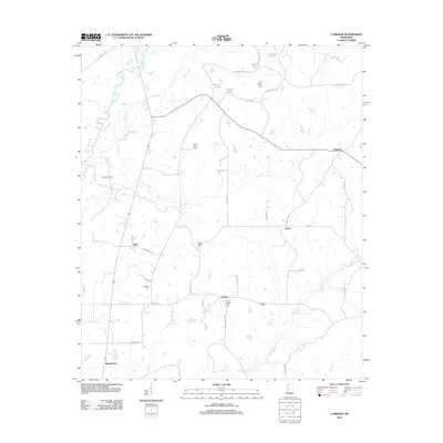
2012 Map of Cameron
USGS Topo · Published 2012About this map
Cameron and Truitt anchor this portion of Madison County, where the rural landscape is defined by the winding course of Big Black River and its complex network of tributaries. The map documents a classic Mississippi agricultural and resource-extraction pattern, notably featuring the Pickens Oil Field in the west. Small settlements like Sharpsburg, Loring, and Oaks are linked by a web of local routes such as Stump Bridge Rd and Vaughan Rd. For genealogists and local historians, the sheet provides precise locations for numerous community landmarks, including Saint Peters Church Cem, Bethel Church Cem, and Soule Chapel Cem. The drainage patterns of Bisland Bayou, Loves Cr, and Hobuck Cr shape the terrain between these long-standing rural church sites and family cemeteries.
Find a feature on this map
53 named features on this map. Tap any name to fly to it.
Don’t see what you’re looking for? This feature index may not catch every label — zoom into the map to look around manually.
Map Details
Editions of this 2012 Cameron Map
This is the sole edition of this map. No revisions or reprints were ever made.
Other maps of this area

1953 · Meridian
USGS Topo · 1:250,000

1955 · Jackson
USGS Topo · 1:250,000

1957 · Meridian
USGS Topo · 1:250,000

1960 · Sharon
USGS Topo · 1:62,500

1961 · Jackson
USGS Topo · 1:250,000

1961 · Canton
USGS Topo · 1:62,500

1962 · Jackson
USGS Topo · 1:250,000

1964 · Camden
USGS Topo · 1:24,000
1964 · Ebenezer
USGS Topo · 1:24,000

1964 · Newport
USGS Topo · 1:24,000