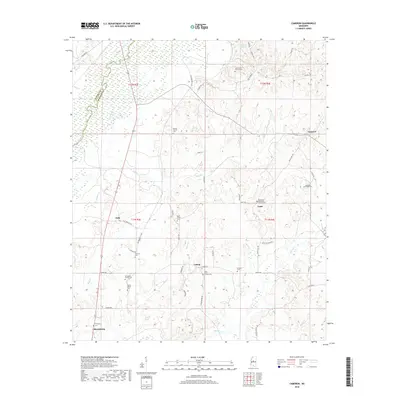
2018 Map of Cameron
USGS Topo · Published 2018About this map
The Big Black River forms the western boundary of this Madison County landscape, where the terrain shifts from river lowlands to a network of creeks and bayous. Small communities such as Loring, Truitt, and Sharpsburg are scattered across the interior, linked by a web of rural roads like Stump Bridge Rd and Old Highway 51 Rd. This region is particularly dense with sites of interest for genealogists, including numerous family and church burial grounds. Williamson Family Cem and Martin Family Cem point to long-standing local ties, while larger communal sites like Saint Peters Church Cem and Rocky Hill Methodist Church Cem anchor the area's rural social history. Waterways like Bisland Bayou and Hobuck Cr define the drainage patterns that shaped early settlement and farm placement in this part of Mississippi.
Find a feature on this map
54 named features on this map. Tap any name to fly to it.
Don’t see what you’re looking for? This feature index may not catch every label — zoom into the map to look around manually.
Map Details
Editions of this 2018 Cameron Map
This is the sole edition of this map. No revisions or reprints were ever made.
Other maps of this area

1953 · Meridian
USGS Topo · 1:250,000

1955 · Jackson
USGS Topo · 1:250,000

1957 · Meridian
USGS Topo · 1:250,000

1960 · Sharon
USGS Topo · 1:62,500

1961 · Jackson
USGS Topo · 1:250,000

1961 · Canton
USGS Topo · 1:62,500

1962 · Jackson
USGS Topo · 1:250,000

1964 · Camden
USGS Topo · 1:24,000
1964 · Ebenezer
USGS Topo · 1:24,000

1964 · Newport
USGS Topo · 1:24,000