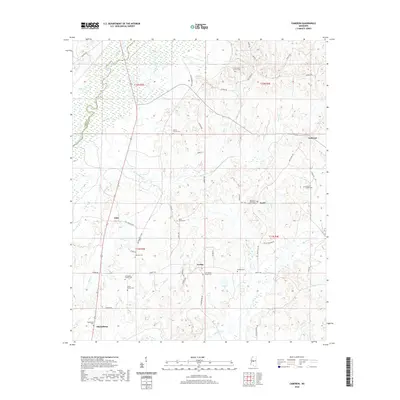
2020 Map of Cameron
USGS Topo · Published 2020About this map
The Big Black River snakes across the northwestern corner of this territory, forming a natural boundary between Yazoo and Madison counties. The landscape is characterized by a dense network of family-held land and rural clusters like Loring, Sharpsburg, and Truitt. Local genealogy is deeply etched into the geography through numerous private and congregational burial sites, including the Williamson Family Cem and Martin Family Cem, which lie just north of Sharpsburg.
Find a feature on this map
57 named features on this map. Tap any name to fly to it.
Don’t see what you’re looking for? This feature index may not catch every label — zoom into the map to look around manually.
Map Details
Editions of this 2020 Cameron Map
This is the sole edition of this map. No revisions or reprints were ever made.
Other maps of this area

1953 · Meridian
USGS Topo · 1:250,000

1955 · Jackson
USGS Topo · 1:250,000

1957 · Meridian
USGS Topo · 1:250,000

1960 · Sharon
USGS Topo · 1:62,500

1961 · Jackson
USGS Topo · 1:250,000

1961 · Canton
USGS Topo · 1:62,500

1962 · Jackson
USGS Topo · 1:250,000

1964 · Camden
USGS Topo · 1:24,000
1964 · Ebenezer
USGS Topo · 1:24,000

1964 · Newport
USGS Topo · 1:24,000