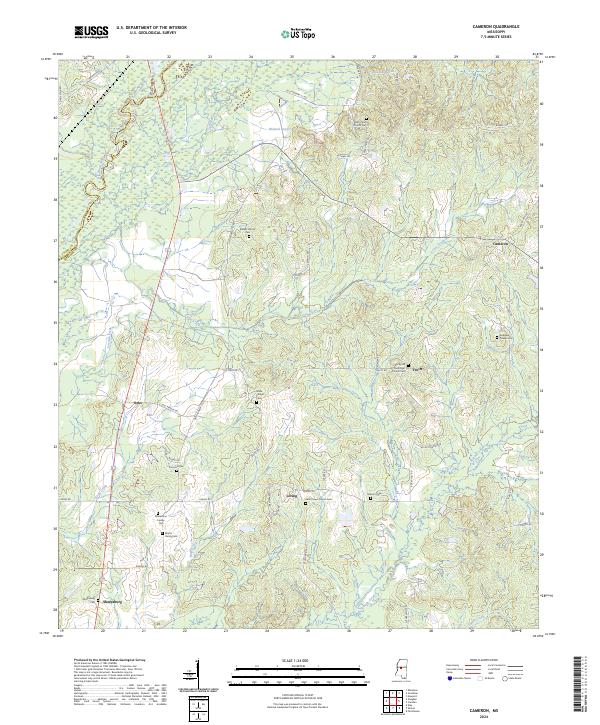
2024 Map of Cameron
USGS Topo · Published 2024About this map
Cameron and its surrounding hamlets occupy the rolling terrain where the Yazoo Co Madison Co border defines the western edge of this survey. This landscape is deeply etched by a network of drainage systems, including Bisland Bayou to the north and the meandering courses of Hag Creek and Loves Creek. The distribution of small settlements like Loring and Truitt reveals a rural pattern centered on crossroad communities and family burial grounds. Notable sites such as the Williamson Family Cem and Martin Family Cem offer significant touchpoints for genealogists tracking early inhabitants. The area's character is further shaped by its religious heritage, anchored by landmarks like Saint Peters Church Cem and Rocky Hill Methodist Church Cem, which remain vital nodes in this part of Mississippi.
Find a feature on this map
59 named features on this map. Tap any name to fly to it.
Don’t see what you’re looking for? This feature index may not catch every label — zoom into the map to look around manually.
Map Details
Editions of this 2024 Cameron Map
This is the sole edition of this map. No revisions or reprints were ever made.
Other maps of this area

1953 · Meridian
USGS Topo · 1:250,000

1955 · Jackson
USGS Topo · 1:250,000

1957 · Meridian
USGS Topo · 1:250,000

1960 · Sharon
USGS Topo · 1:62,500

1961 · Jackson
USGS Topo · 1:250,000

1961 · Canton
USGS Topo · 1:62,500

1962 · Jackson
USGS Topo · 1:250,000

1964 · Camden
USGS Topo · 1:24,000
1964 · Ebenezer
USGS Topo · 1:24,000

1964 · Newport
USGS Topo · 1:24,000