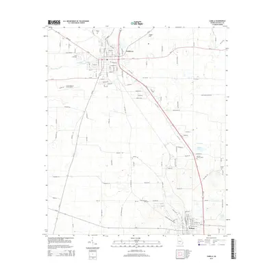
2014 Map of Camilla
USGS Topo · Published 2014About this map
The city of Camilla serves as the central hub for this corner of Mitchell County, anchored by its proximity to the Camilla-Mitchell County Airport and a grid of streets including Main St and Industrial Blvd. To the south, the city of Pelham marks the edge of the survey, connected by a network of rural roads that bisect the agricultural landscape. The terrain is defined by natural drainage and depressions, most notably Big Slough and the distinctive geological feature Tuggles Sink. Genealogists will find several significant burial sites across the quadrangle, ranging from Oakview Cem near the city center to Pinecrest Memory Gardens and Mt Eble Cem further east. The transition from town to timber and farmland is evident in the naming of rural thoroughfares such as Strawberry Rd and Martin Farms Rd.
Find a feature on this map
119 named features on this map. Tap any name to fly to it.
Don’t see what you’re looking for? This feature index may not catch every label — zoom into the map to look around manually.
Map Details
Editions of this 2014 Camilla Map
This is the sole edition of this map. No revisions or reprints were ever made.
Other maps of this area

1953 · Dothan
USGS Topo · 1:250,000

1954 · Dothan
USGS Topo · 1:250,000

1955 · Dothan
USGS Topo · 1:250,000

1956 · Baconton
USGS Topo · 1:62,500

1956 · Newton
USGS Topo · 1:62,500

1971 · Meigs
USGS Topo · 1:24,000

1971 · Gee Pond
USGS Topo · 1:24,000

1971 · Camilla
USGS Topo · 1:24,000

1971 · Cotton
USGS Topo · 1:24,000
1971 · Pelham
USGS Topo · 1:24,000