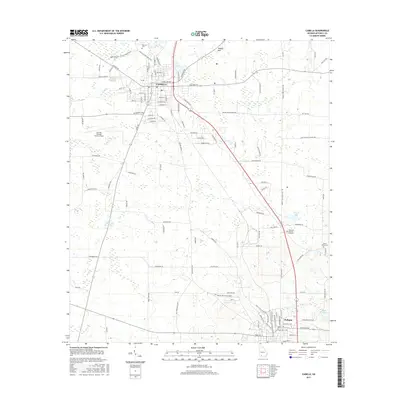
2017 Map of Camilla
USGS Topo · Published 2017About this map
Camilla and Pelham serve as the primary hubs in this Mitchell County landscape, connected by a network of rural routes and established corridors like Old Pelham Rd. The area is characterized by agricultural stretches and drainage features such as Big Slough and Tuggles Sink, reflecting the unique hydrology of southwest Georgia. Local history and genealogy are preserved through several documented burial grounds, including Oakview Cem and Pinecrest Memory Gardens, which anchor the outskirts of these communities. Transport infrastructure is prominent, featuring the Camilla-Mitchell County Airport and historic river access points suggested by Baggs Ferry Rd. The placement of Howell Lake and Hand Lake near the southeastern edge highlights the localized water bodies that have historically influenced rural settlement patterns and land use between these two regional towns.
Find a feature on this map
55 named features on this map. Tap any name to fly to it.
Don’t see what you’re looking for? This feature index may not catch every label — zoom into the map to look around manually.
Map Details
Editions of this 2017 Camilla Map
This is the sole edition of this map. No revisions or reprints were ever made.
Other maps of this area

1953 · Dothan
USGS Topo · 1:250,000

1954 · Dothan
USGS Topo · 1:250,000

1955 · Dothan
USGS Topo · 1:250,000

1956 · Baconton
USGS Topo · 1:62,500

1956 · Newton
USGS Topo · 1:62,500

1971 · Meigs
USGS Topo · 1:24,000

1971 · Gee Pond
USGS Topo · 1:24,000

1971 · Camilla
USGS Topo · 1:24,000

1971 · Cotton
USGS Topo · 1:24,000
1971 · Pelham
USGS Topo · 1:24,000