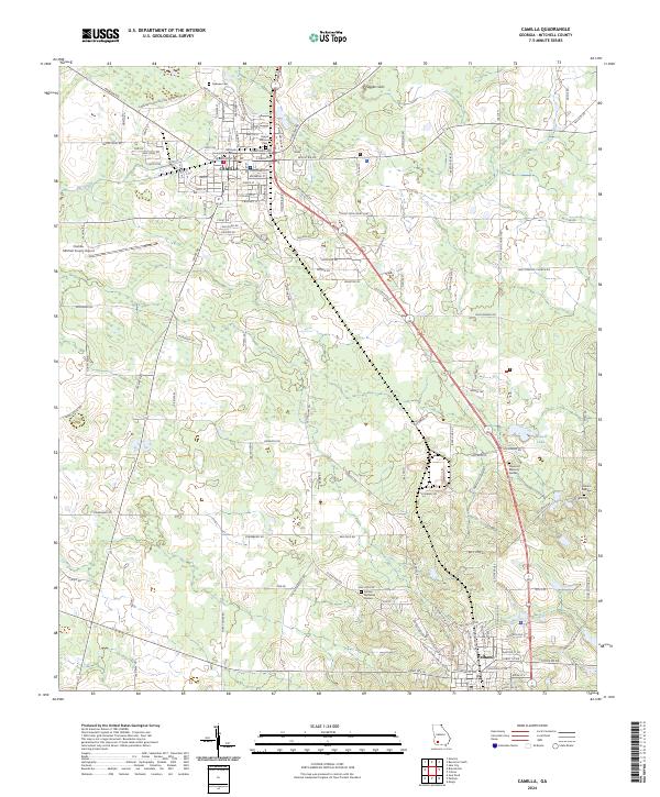
2024 Map of Camilla
USGS Topo · Published 2024About this map
The Mitchell County Courthouse serves as the focal point for the city of Camilla, situated at a key crossroads where Cairo Rd and Old State Rte 3 meet. This South Georgia landscape is defined by its agricultural and cemetery history, featuring numerous preservation sites such as the Sunset Historical Cem and the Oakview Cem near the town center. The terrain is marked by karst-like depressions such as Tuggles Sink and the winding course of Big Slough to the west. Towards the south, the map captures the outskirts of Pelham, including the Pelham Memorial Garden. This modern survey illustrates the persistent importance of regional air travel at the Camilla- Mitchell County Airport and the complex web of rural roads, including Lake Pleasant Church Rd and Baggs Ferry Rd, which connect the scattered homesteads and farms of Mitchell County.
Find a feature on this map
127 named features on this map. Tap any name to fly to it.
Don’t see what you’re looking for? This feature index may not catch every label — zoom into the map to look around manually.
Map Details
Editions of this 2024 Camilla Map
This is the sole edition of this map. No revisions or reprints were ever made.
Other maps of this area

1953 · Dothan
USGS Topo · 1:250,000

1954 · Dothan
USGS Topo · 1:250,000

1955 · Dothan
USGS Topo · 1:250,000

1956 · Baconton
USGS Topo · 1:62,500

1956 · Newton
USGS Topo · 1:62,500

1971 · Meigs
USGS Topo · 1:24,000

1971 · Gee Pond
USGS Topo · 1:24,000

1971 · Camilla
USGS Topo · 1:24,000

1971 · Cotton
USGS Topo · 1:24,000
1971 · Pelham
USGS Topo · 1:24,000