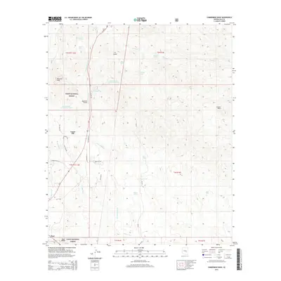
2014 Map of Cammerman Wash
USGS Topo · Published 2014About this map
Copper Hill sits at the center of this 2014 survey, highlighting the complex drainage systems of the Gila County landscape. The area is defined by the extensive reaches of Cammerman Wash and Ramboz Wash, which cut through a terrain of high points like Quartzite Peak and Granite Butte. The settlement of Pinal is visible along the southern edge, while East Globe occupies the southwestern corner, showing the proximity of these communities to the protected lands of the Tonto National Forest. Numerous water resources are documented, from Cammerman Spring and Apache Spring to engineered catchments like Champion Tank and Butta Tank, illustrating the critical management of water in this arid environment. Modern infrastructure, including US Hwy 60 and Bia-810, provides access through the rugged foothills and canyons such as CK Canyon.
Find a feature on this map
43 named features on this map. Tap any name to fly to it.
Don’t see what you’re looking for? This feature index may not catch every label — zoom into the map to look around manually.
Map Details
Editions of this 2014 Cammerman Wash Map
This is the sole edition of this map. No revisions or reprints were ever made.
Other maps of this area

1901 · Globe
USGS Topo · 1:62,500

1902 · Globe
USGS Topo · 1:62,500

1922 · Chrysotile
USGS Topo · 1:125,000

1945 · Globe
USGS Topo · 1:24,000

1949 · Rockinstraw Mtn
USGS Topo · 1:62,500

1950 · Rockinstraw Mtn
USGS Topo · 1:62,500

1954 · Mesa
USGS Topo · 1:250,000

1957 · Mesa
USGS Topo · 1:250,000

1958 · Mesa
USGS Topo · 1:250,000

1960 · Mesa
USGS Topo · 1:250,000