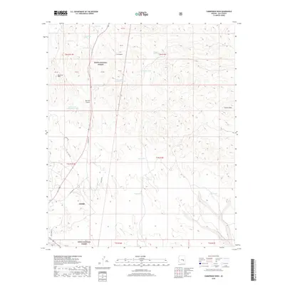
2018 Map of Cammerman Wash
USGS Topo · Published 2018About this map
Globe sits at the southwestern edge of this landscape, where the urban boundary meets the expansive Tonto National Forest. The terrain is defined by a dense network of drainages and high points, including Quartzite Peak and Granite Butte. A reliance on water management is evident throughout the survey, with numerous named tanks such as Butta Tank, Hayes Tank, and Reservation Tank Number Two providing critical collection points for livestock or local needs. These tanks, along with natural sources like Apache Spring and Cammerman Spring, are the primary landmarks in an area dominated by canyons such as C K Canyon and Quartzite Canyon. Old US Hwy 60 and Ramboz Wash cut through the lower elevations, illustrating the traditional transit corridors that navigate this portion of Gila County. The map provides a look at the transitional zone where human settlement gives way to the protected forest interior.
Find a feature on this map
32 named features on this map. Tap any name to fly to it.
Don’t see what you’re looking for? This feature index may not catch every label — zoom into the map to look around manually.
Map Details
Editions of this 2018 Cammerman Wash Map
This is the sole edition of this map. No revisions or reprints were ever made.
Other maps of this area

1901 · Globe
USGS Topo · 1:62,500

1902 · Globe
USGS Topo · 1:62,500

1922 · Chrysotile
USGS Topo · 1:125,000

1945 · Globe
USGS Topo · 1:24,000

1949 · Rockinstraw Mtn
USGS Topo · 1:62,500

1950 · Rockinstraw Mtn
USGS Topo · 1:62,500

1954 · Mesa
USGS Topo · 1:250,000

1957 · Mesa
USGS Topo · 1:250,000

1958 · Mesa
USGS Topo · 1:250,000

1960 · Mesa
USGS Topo · 1:250,000