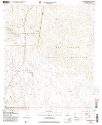
2004 Map of Cammerman Wash
USGS Topo · Published 2007About this map
Tonto National Forest and the San Carlos Apache Reservation meet in this desert landscape of Gila County, defined by the dry course of Cammerman Wash and the surrounding high ground of Quartzite Peak. The southern portion of the map documents a concentrated area of state and local infrastructure, including the Gila County Fairground, the State Prison, and the State Highway District Headquarters.
Find a feature on this map
33 named features on this map. Tap any name to fly to it.
Don’t see what you’re looking for? This feature index may not catch every label — zoom into the map to look around manually.
Map Details
Editions of this 2004 Cammerman Wash Map
This is the sole edition of this map. No revisions or reprints were ever made.
Other maps of this area

1901 · Globe
USGS Topo · 1:62,500

1902 · Globe
USGS Topo · 1:62,500

1922 · Chrysotile
USGS Topo · 1:125,000

1945 · Globe
USGS Topo · 1:24,000

1949 · Rockinstraw Mtn
USGS Topo · 1:62,500

1950 · Rockinstraw Mtn
USGS Topo · 1:62,500

1954 · Mesa
USGS Topo · 1:250,000

1957 · Mesa
USGS Topo · 1:250,000

1958 · Mesa
USGS Topo · 1:250,000

1960 · Mesa
USGS Topo · 1:250,000