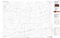
1984 Map of Camp Creek
USGS Topo · Published 1984About this map
The rural expanse of Meade County is defined by the high ground of Fox Ridge and the Butte Divide, where the landscape transitions into a complex web of seasonal drainage. Small agricultural settlements like Fairpoint, Enning, and Union Center serve as anchors for the ranching community in the mid-1980s. The presence of specialized infrastructure such as the Vig Limousin Ranch Airstrip and Engalls Landing Strip underscores the reliance on private aviation for navigating this wide-open territory.
Find a feature on this map
75 named features on this map. Tap any name to fly to it.
Don’t see what you’re looking for? This feature index may not catch every label — zoom into the map to look around manually.
Map Details
Editions of this 1984 Camp Creek Map
2 editions found
Other maps of this area

1893 · Rapid
USGS Topo · 1:125,000

1898 · Rapid
USGS Topo · 1:125,000

1903 · Rapid
USGS Topo · 1:125,000

1913 · Newell
USGS Topo · 1:125,000

1935 · Hoover
USGS Topo · 1:125,000

1951 · Cedar Canyon
USGS Topo · 1:24,000

1951 · Maurine
USGS Topo · 1:24,000

1951 · Volunteer SE
USGS Topo · 1:24,000

1952 · Deep Creek SE
USGS Topo · 1:24,000

1952 · Signal Butte
USGS Topo · 1:24,000