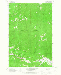
1964 Map of Camp Creek
USGS Topo · Published 1967About this map
The Lolo National Forest dominates this mid-1960s landscape, where the Grave Creek Range and Lolo Range converge. This area of Missoula County is defined by its drainage systems, with Lolo Creek serving as the primary corridor for human activity along the southern edge. The small cluster of infrastructure near the Woodman Sch and the winding Woodman Road suggests a pocket of rural settlement amid the steep terrain of the Bitterroot Mountains.
Find a feature on this map
24 named features on this map. Tap any name to fly to it.
Don’t see what you’re looking for? This feature index may not catch every label — zoom into the map to look around manually.
Map Details
Editions of this 1964 Camp Creek Map
2 editions found
Other maps of this area

1912 · Missoula
USGS Topo · 1:125,000

1956 · Hamilton
USGS Topo · 1:250,000

1959 · Hamilton
USGS Topo · 1:250,000

1960 · Hamilton
USGS Topo · 1:250,000

1963 · Primrose
USGS Topo · 1:24,000

1964 · Hamilton
USGS Topo · 1:250,000
1964 · Diamond Point
USGS Topo · 1:24,000

1964 · Garden Point
USGS Topo · 1:24,000

1964 · Dick Creek
USGS Topo · 1:24,000

1964 · West Fork Butte
USGS Topo · 1:24,000