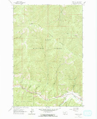
1964 Map of Camp Creek
USGS Topo · Published 1967About this map
Lolo National Forest dominates this mid-1960s terrain, where the sharp ridges of the Grave Creek Range and Lolo Range define the northern and central landscape. Settlement is concentrated along the southern valley floor where Lolo Creek flows. Here, the presence of the Woodman Sch and various mountain drainages like South Fork Lolo Creek and Camp Creek suggest a quiet, established mountain community centered on the river and road corridor.
Find a feature on this map
28 named features on this map. Tap any name to fly to it.
Don’t see what you’re looking for? This feature index may not catch every label — zoom into the map to look around manually.
Map Details
Editions of this 1964 Camp Creek Map
2 editions found
Other maps of this area

1912 · Missoula
USGS Topo · 1:125,000

1956 · Hamilton
USGS Topo · 1:250,000

1959 · Hamilton
USGS Topo · 1:250,000

1960 · Hamilton
USGS Topo · 1:250,000

1963 · Primrose
USGS Topo · 1:24,000

1964 · Hamilton
USGS Topo · 1:250,000
1964 · Diamond Point
USGS Topo · 1:24,000

1964 · Garden Point
USGS Topo · 1:24,000

1964 · Dick Creek
USGS Topo · 1:24,000

1964 · West Fork Butte
USGS Topo · 1:24,000