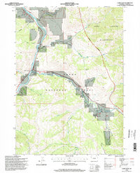
1996 Map of Camp Davis
USGS Topo · Published 1998About this map
Hoback Junction serves as the primary gateway at the confluence of the Snake River and the Hoback River, defining the transportation and settlement pattern in this corner of the Teton National Forest. This late-twentieth-century survey documents the working landscape of the canyon, where traditional ranching infrastructure like the Broken Arrow Ranch and various corrals sits alongside established landmarks such as Lafayette Station and Camp Davis.
Find a feature on this map
37 named features on this map. Tap any name to fly to it.
Don’t see what you’re looking for? This feature index may not catch every label — zoom into the map to look around manually.
Map Details
Editions of this 1996 Camp Davis Map
This is the sole edition of this map. No revisions or reprints were ever made.
Other maps of this area

1931 · Jackson
USGS Topo · 1:125,000

1935 · Jackson
USGS Topo · 1:125,000

1955 · Driggs
USGS Topo · 1:250,000

1958 · Driggs
USGS Topo · 1:250,000

1962 · Driggs
USGS Topo · 1:250,000

1963 · Munger Mountain
USGS Topo · 1:24,000

1963 · Jackson
USGS Topo · 1:24,000

1965 · Camp Davis
USGS Topo · 1:24,000
1965 · Turquoise Lake
USGS Topo · 1:24,000
1965 · Cache Creek
USGS Topo · 1:24,000