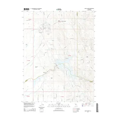
2015 Map of Camp Far West
USGS Topo · Published 2015About this map
Waldo Junction sits at the northern edge of this landscape where the Sacramento Valley meets the foothills. The terrain is defined by a network of seasonal watercourses and drainage features, including Grasshopper Slough, Best Slough, and numerous named ravines such as Albion Ravine and Fenton Ravine. This area is historically significant as the location of the Camp Far West Historical Site, situated near the banks of the Bear River. The local water infrastructure is prominent, featuring the Camp Far W Reservoir and the Camp Far W Ditch, which support the agricultural needs of the Central Valley. For those researching local family history, the presence of the Lofton Cemetery provides a specific point of genealogical interest amidst the winding roads like Waldo Rd and Spenceville Rd.
Find a feature on this map
87 named features on this map. Tap any name to fly to it.
Don’t see what you’re looking for? This feature index may not catch every label — zoom into the map to look around manually.
Map Details
Editions of this 2015 Camp Far West Map
This is the sole edition of this map. No revisions or reprints were ever made.
Other maps of this area

1888 · Smartsville
USGS Topo · 1:125,000

1891 · Sacramento
USGS Topo · 1:125,000

1891 · Smartsville
USGS Topo · 1:125,000

1892 · Sacramento
USGS Topo · 1:125,000

1892 · Smartsville
USGS Topo · 1:125,000

1893 · Sacramento
USGS Topo · 1:125,000

1894 · Smartsville
USGS Topo · 1:125,000

1895 · Smartsville
USGS Topo · 1:125,000

1910 · Sheridan
USGS Topo · 1:31,680

1910 · Lincoln
USGS Topo · 1:31,680