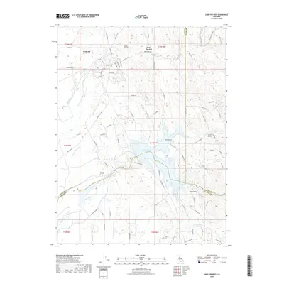
2018 Map of Camp Far West
USGS Topo · Published 2018About this map
Waldo Junction stands as a central point in this landscape where the borders of Yuba, Placer, and Nevada counties converge near the Bear River. The northern portion of the map is dominated by the sprawling infrastructure of Beale AFB, including Beale Lake and a network of residential ways such as Grand Way and Lark Dr. Historically significant sites for genealogists include the colorfully named Cabbage Patch Cem, as well as Lofton Cem and the Camp Far West Cem located near the reservoir's edge.
Find a feature on this map
86 named features on this map. Tap any name to fly to it.
Don’t see what you’re looking for? This feature index may not catch every label — zoom into the map to look around manually.
Map Details
Editions of this 2018 Camp Far West Map
This is the sole edition of this map. No revisions or reprints were ever made.
Other maps of this area

1888 · Smartsville
USGS Topo · 1:125,000

1891 · Sacramento
USGS Topo · 1:125,000

1891 · Smartsville
USGS Topo · 1:125,000

1892 · Sacramento
USGS Topo · 1:125,000

1892 · Smartsville
USGS Topo · 1:125,000

1893 · Sacramento
USGS Topo · 1:125,000

1894 · Smartsville
USGS Topo · 1:125,000

1895 · Smartsville
USGS Topo · 1:125,000

1910 · Sheridan
USGS Topo · 1:31,680

1910 · Lincoln
USGS Topo · 1:31,680