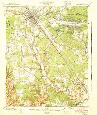
1941 Map of Camp Forrest
USGS Topo · Published 1943About this map
Camp Forrest Military Reservation dominates the landscape in this 1941 Tennessee Valley Authority and War Department survey, reflecting the rapid mobilization of the Second World War era. Centered near Tullahoma, the map captures the extensive military infrastructure including the Camp Forrest Headquarters, a Filtration Plant, and a Disposal Plant, all situated along the Nashville Chattanooga and St Louis railroad line.
Find a feature on this map
53 named features on this map. Tap any name to fly to it.
Don’t see what you’re looking for? This feature index may not catch every label — zoom into the map to look around manually.
Map Details
Editions of this 1941 Camp Forrest Map
2 editions found
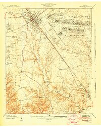
Other maps of this area

1928 · Decherd
USGS Topo · 1:62,500

1936 · Ovoca
USGS Topo · 1:24,000

1936 · Manchester
USGS Topo · 1:24,000

1936 · Cumberland Springs
USGS Topo · 1:24,000

1936 · Winchester
USGS Topo · 1:24,000

1936 · Belvidere
USGS Topo · 1:24,000

1936 · Camp Peay
USGS Topo · 1:24,000

1936 · Capitol Hill
USGS Topo · 1:24,000

1936 · Normandy
USGS Topo · 1:24,000

1936 · Lois
USGS Topo · 1:24,000