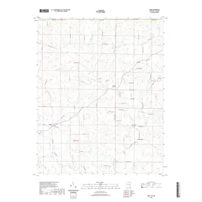
2020 Map of Camp
USGS Topo · Published 2020About this map
Camp and Fryatt anchor this rural landscape in the Ozark foothills, where the Arkansas-Missouri state line is defined by Missouri Line Rd and the Howell Co Fulton Co boundary. The area is defined by an intricate network of narrow valleys, or hollows, such as Thornton Hollow and Glass Hollow, which drain into larger watercourses like Myatt Creek. Historically significant family and community landmarks are scattered throughout the terrain, including Fryatt Cem and Shiloh Cem, alongside natural water sources like Bald Spring and More Spring. The presence of labels like Mill Pond Br and Mill Hollow suggests a legacy of local water-powered industry that once served these upland settlements. Modern transit is represented by a web of local roads, such as Pleasant Valley Rd and French Town Rd, which follow the winding topography between the ridges and stream beds.
Find a feature on this map
85 named features on this map. Tap any name to fly to it.
Don’t see what you’re looking for? This feature index may not catch every label — zoom into the map to look around manually.
Map Details
Editions of this 2020 Camp Map
This is the sole edition of this map. No revisions or reprints were ever made.
Other maps of this area

1943 · Thayer
USGS Topo · 1:62,500

1944 · West Plains
USGS Topo · 1:62,500

1946 · Thayer
USGS Topo · 1:62,500

1946 · West Plains
USGS Topo · 1:62,500

1950 · Salem
USGS Topo · 1:62,500

1951 · Salem
USGS Topo · 1:62,500

1957 · Poplar Bluff
USGS Topo · 1:250,000

1959 · Poplar Bluff
USGS Topo · 1:250,000

1960 · Poplar Bluff
USGS Topo · 1:250,000

1962 · Stuart
USGS Topo · 1:24,000