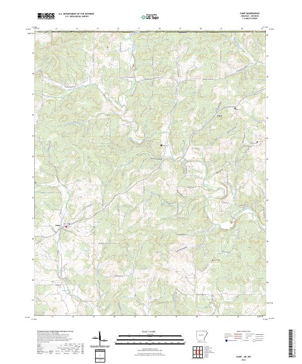
2024 Map of Camp
USGS Topo · Published 2024About this map
The community of Camp and the settlement of Fryatt anchor this upland landscape in Fulton County, where a network of seasonal branches and hollows defines the local topography. This 2024 edition highlights a rural geography structured by drainage systems like Myatt Creek and the Pine Creek valley, punctuated by several historic burial grounds including Fryatt Cem, Kerby Cem, and Bethel Cem. The map reveals a transition in naming conventions from the family-derived Thornton Hollow and Glass Hollow to contemporary access routes such as Missouri Line Rd and Catapillar Trl. Researchers can trace the winding paths of Elm Spring Branch and Mill Creek through the north-central sections, illustrating how early habitation followed the reliable water sources of the Ozark foothills.
Find a feature on this map
84 named features on this map. Tap any name to fly to it.
Don’t see what you’re looking for? This feature index may not catch every label — zoom into the map to look around manually.
Map Details
Editions of this 2024 Camp Map
This is the sole edition of this map. No revisions or reprints were ever made.
Other maps of this area

1943 · Thayer
USGS Topo · 1:62,500

1944 · West Plains
USGS Topo · 1:62,500

1946 · Thayer
USGS Topo · 1:62,500

1946 · West Plains
USGS Topo · 1:62,500

1950 · Salem
USGS Topo · 1:62,500

1951 · Salem
USGS Topo · 1:62,500

1957 · Poplar Bluff
USGS Topo · 1:250,000

1959 · Poplar Bluff
USGS Topo · 1:250,000

1960 · Poplar Bluff
USGS Topo · 1:250,000

1962 · Stuart
USGS Topo · 1:24,000