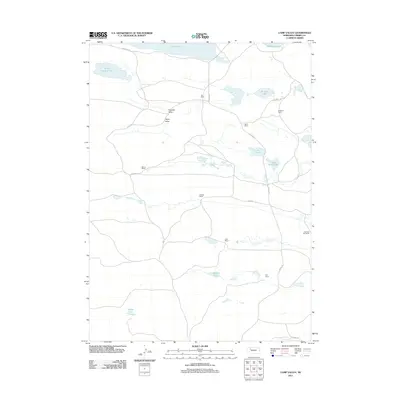
2011 Map of Camp Valley
USGS Topo · Published 2011About this map
The Nebraska Sandhills define this portion of Cherry County, where the landscape is organized around the expansive Camp Valley and neighboring Hospital Valley. In this ranching-dominated territory, large private holdings serve as the primary landmarks, including the JHL Ranch, Ferguson Ranch, and Sterns Ranch. The terrain is characterized by a high density of semi-permanent water bodies typical of the region, ranging from the large Alkali Lake on the northern border to smaller features like School Section Lake, Shigley Lake, and Melvin Lake. A sparse network of local routes, such as N Ashby Rd and Stearns Dr, connects these isolated homesteads. The distribution of named ranches like the Diamond Bar Ranch and Egan Ranch illustrates the expansive, low-density settlement pattern required by the local cattle economy in the early 21st century.
Find a feature on this map
26 named features on this map. Tap any name to fly to it.
Don’t see what you’re looking for? This feature index may not catch every label — zoom into the map to look around manually.
Map Details
Editions of this 2011 Camp Valley Map
This is the sole edition of this map. No revisions or reprints were ever made.
Other maps of this area

1948 · Ashby
USGS Topo · 1:62,500

1948 · Bingham
USGS Topo · 1:62,500

1948 · Spade Ranch
USGS Topo · 1:62,500

1949 · Ashby
USGS Topo · 1:62,500

1949 · Turpin Lake
USGS Topo · 1:62,500

1950 · Spade Ranch
USGS Topo · 1:62,500

1950 · Bingham
USGS Topo · 1:62,500

1951 · Turpin Lake
USGS Topo · 1:62,500

1955 · Alliance
USGS Topo · 1:250,000

1957 · Alliance
USGS Topo · 1:250,000