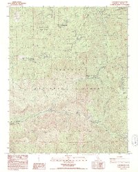
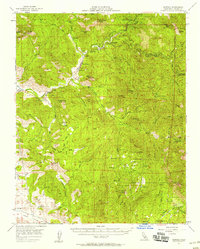
1987 Map of Camp Wishon
USGS Topo · Published 1987About this map
The Middle Fork Tule River and its intricate tributaries dominate this 1980s landscape, illustrating the complex intersection of public forest management and mountain recreation in Tulare County. The terrain is characterized by the convergence of the Mountain Home State Forest, Balch County Park, and Sequoia National Forest. Notable facilities like the State Forest Headquarters and the Mountain Home Conservation Camp indicate the active administration of these lands, while the presence of a Fish Hatchery near Mahogany Flat underscores the importance of watershed management. Human settlement is scattered across sites like Buck Horn Ranch and Bare Ranch, alongside numerous recreational outposts such as Camp Wishon Campground and Frasier Mill Campground. The map also documents resource extraction and wilderness preservation through labels for a Quarry, Mine Prospect, and the Golden Trout Wilderness.
Find a feature on this map
51 named features on this map. Tap any name to fly to it.
Don’t see what you’re looking for? This feature index may not catch every label — zoom into the map to look around manually.
Map Details
Editions of this 1987 Camp Wishon Map
2 editions found
Other maps of this area

1904 · Kaweah
USGS Topo · 1:125,000

1909 · Kaweah
USGS Topo · 1:125,000

1937 · Kaweah
USGS Topo · 1:125,000

1948 · Fresno
USGS Topo · 1:250,000

1955 · Fresno
USGS Topo · 1:250,000

1956 · Fresno
USGS Topo · 1:250,000
1956 · Globe
USGS Topo · 1:24,000

1956 · Mineral King
USGS Topo · 1:62,500
1956 · Camp Nelson
USGS Topo · 1:62,500
1957 · Kaweah
USGS Topo · 1:62,500