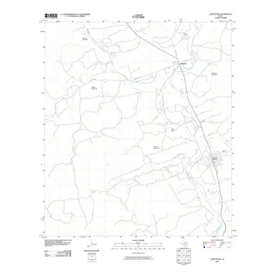
2010 Map of Camp Wood
USGS Topo · Published 2010About this map
The Nueces River valley defines the character of this Real County landscape, where the settlements of Camp Wood and Barksdale serve as the primary hubs. This area is a transition between river bottomlands and high relief, marked by prominent peaks such as Military Mountain, Powers Mountain, and Meridian Mountain. Local history and community roots are evident at the Garden of Memories cemetery and Camp Fawcett, situated along the upper reaches of the river system.
Find a feature on this map
38 named features on this map. Tap any name to fly to it.
Don’t see what you’re looking for? This feature index may not catch every label — zoom into the map to look around manually.
Map Details
Editions of this 2010 Camp Wood Map
This is the sole edition of this map. No revisions or reprints were ever made.
Other maps of this area

1893 · Nueces
USGS Topo · 1:125,000

1896 · Nueces
USGS Topo · 1:125,000

1944 · Barksdale
USGS Topo · 1:62,500

1947 · Hackberry
USGS Topo · 1:62,500

1954 · San Antonio
USGS Topo · 1:250,000

1957 · San Antonio
USGS Topo · 1:250,000

1957 · York Hollow
USGS Topo · 1:62,500

1958 · Del Rio
USGS Topo · 1:250,000

1964 · Del Rio
USGS Topo · 1:250,000
1971 · Lake Creek
USGS Topo · 1:24,000