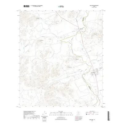
2019 Map of Camp Wood
USGS Topo · Published 2019About this map
The Nueces River valley anchors this area of Southwest Texas, carving a deep path between the high ridges of the Balcones Escarpment. The settlement of Camp Wood occupies the river’s eastern bank, while Barksdale sits just to the north across the Edwards County and Real County line. The landscape is defined by its water sources, including the significant Camp Wood Spring and Old Faithful Spring, which have sustained life in this arid canyon environment for generations.
Find a feature on this map
59 named features on this map. Tap any name to fly to it.
Don’t see what you’re looking for? This feature index may not catch every label — zoom into the map to look around manually.
Map Details
Editions of this 2019 Camp Wood Map
This is the sole edition of this map. No revisions or reprints were ever made.
Other maps of this area

1893 · Nueces
USGS Topo · 1:125,000

1896 · Nueces
USGS Topo · 1:125,000

1944 · Barksdale
USGS Topo · 1:62,500

1947 · Hackberry
USGS Topo · 1:62,500

1954 · San Antonio
USGS Topo · 1:250,000

1957 · San Antonio
USGS Topo · 1:250,000

1957 · York Hollow
USGS Topo · 1:62,500

1958 · Del Rio
USGS Topo · 1:250,000

1964 · Del Rio
USGS Topo · 1:250,000
1971 · Lake Creek
USGS Topo · 1:24,000