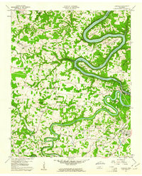
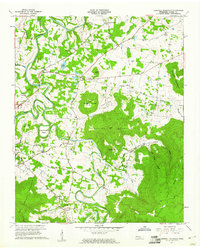
1960 Map of Campaign
USGS Topo · Published 1961About this map
The Louisville and Nashville Railroad cuts through the southeastern corner of this landscape, anchoring the settlement of Campaign and nearby Rock Station during the early 1960s. This territory is defined by the winding course of the Caney Fork and Collins River, which feed into the Center Hill Reservoir and Great Falls Lake. The infrastructure of the era is evident at the Great Falls Hydro Plant and the Intake structures near the river junction. Further inland, the map records a dense network of rural life, featuring numerous small congregations such as Antioch Ch, New Union Ch, and the Old Bybee Chapel. The topography is marked by significant bends in the river system, including Horseshoe Bend and Wright Bend, which create distinct peninsulas that were home to early schools and communities like Moores College and Keltonburg.
Find a feature on this map
60 named features on this map. Tap any name to fly to it.
Don’t see what you’re looking for? This feature index may not catch every label — zoom into the map to look around manually.
Map Details
Editions of this 1960 Campaign Map
4 editions found
Other maps of this area

1893 · Mc Minnville
USGS Topo · 1:125,000

1895 · Mc Minnville
USGS Topo · 1:125,000

1942 · Statesville
USGS Topo · 1:100,000

1943 · Cookeville
USGS Topo · 1:100,000

1943 · Mc Minnville
USGS Topo · 1:100,000

1944 · Cookeville
USGS Topo · 1:100,000

1953 · Chattanooga
USGS Topo · 1:250,000

1953 · Mc Minnville
USGS Topo · 1:24,000
1957 · Cardwell Mountain
USGS Topo · 1:24,000

1957 · Chattanooga
USGS Topo · 1:250,000