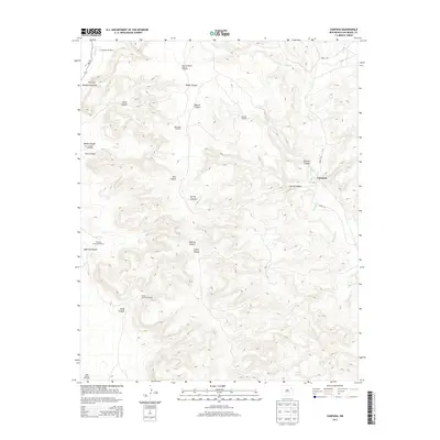
2013 Map of Campana
USGS Topo · Published 2013About this map
Campana and the surrounding ranchlands of San Miguel County are defined by an intricate network of drainage canyons and scattered water sources in this 2013 survey. The landscape is carved by numerous seasonal watercourses including Atarque Creek, Medio Creek, and Seco Creek, which have sculpted prominent landforms like Muertos Canyon and Polecat Canyon. This arid environment relies heavily on a system of distributed windmills for livestock and ranching operations, with functional landmarks such as the Medio Shipping Pasture Windmill and Rock Hole Windmill serving as vital infrastructure.
Find a feature on this map
26 named features on this map. Tap any name to fly to it.
Don’t see what you’re looking for? This feature index may not catch every label — zoom into the map to look around manually.
Map Details
Editions of this 2013 Campana Map
This is the sole edition of this map. No revisions or reprints were ever made.
Other maps of this area

1930 · Tucumcari
USGS Topo · 1:125,000

1954 · Santa Fe
USGS Topo · 1:250,000

1954 · Tucumcari
USGS Topo · 1:250,000

1958 · Santa Fe
USGS Topo · 1:250,000

1958 · Tucumcari
USGS Topo · 1:250,000

1968 · La Cinta Mesa
USGS Topo · 1:24,000

1968 · Carpenter Mesa NW
USGS Topo · 1:24,000
1968 · Medina Mesa
USGS Topo · 1:24,000

1969 · Salitre Canyon
USGS Topo · 1:24,000
1969 · Alamosa Canyon
USGS Topo · 1:24,000