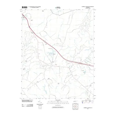
2010 Map of Campbell Junction
USGS Topo · Published 2010About this map
Verble Hollow and Dripping Springs mark the highland landscape of the Cumberland Plateau in this 2010 survey of Putnam and Cumberland Counties. The topography is defined by significant drainage systems, including the Caney Fork and Clear Creek, which carve through terrain featuring landmarks such as Stillhouse Rock and Funnel Rock. The map illustrates a rural settlement pattern where long-established family names are preserved in locations like Welch Cemetery and Pugh Cemetery, alongside recreational and institutional sites such as Camp Nakanawa. A network of historic and modern thoroughfares, including Old Walton Rd and High Rock Loop, connects the scattered communities of Welch and The Cowpens. Small-scale water management is evident in the presence of Mayland Lake Dam and Hood Lake Dam, supporting local hydrology near the Verble Knobs.
Find a feature on this map
88 named features on this map. Tap any name to fly to it.
Don’t see what you’re looking for? This feature index may not catch every label — zoom into the map to look around manually.
Map Details
Editions of this 2010 Campbell Junction Map
This is the sole edition of this map. No revisions or reprints were ever made.
Other maps of this area

1892 · Pikeville
USGS Topo · 1:125,000

1895 · Pikeville
USGS Topo · 1:125,000

1897 · Standingstone
USGS Topo · 1:125,000

1898 · Standingstone
USGS Topo · 1:125,000

1912 · Crossville
USGS Topo · 1:62,500

1935 · Isoline
USGS Topo · 1:24,000

1935 · Campbell Junction
USGS Topo · 1:24,000

1935 · Clarkrange
USGS Topo · 1:24,000
1936 · Crossville
USGS Topo · 1:24,000

1943 · Cookeville
USGS Topo · 1:100,000