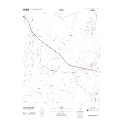
2013 Map of Campbell Junction
USGS Topo · Published 2013About this map
Campbell Junction and the surrounding plateau communities are captured here during a period of modern connectivity, where the intersection of Interstate 40 and local routes defines the landscape's movement. The map highlights the historic footprint of Mayland and the long-standing youth retreat of Camp Nakanawa at Mayland Lake, reflecting the region's dual identity as a residential corridor and a recreational destination.
Find a feature on this map
151 named features on this map. Tap any name to fly to it.
Don’t see what you’re looking for? This feature index may not catch every label — zoom into the map to look around manually.
Map Details
Editions of this 2013 Campbell Junction Map
This is the sole edition of this map. No revisions or reprints were ever made.
Other maps of this area

1892 · Pikeville
USGS Topo · 1:125,000

1895 · Pikeville
USGS Topo · 1:125,000

1897 · Standingstone
USGS Topo · 1:125,000

1898 · Standingstone
USGS Topo · 1:125,000

1912 · Crossville
USGS Topo · 1:62,500

1935 · Isoline
USGS Topo · 1:24,000

1935 · Campbell Junction
USGS Topo · 1:24,000

1935 · Clarkrange
USGS Topo · 1:24,000
1936 · Crossville
USGS Topo · 1:24,000

1943 · Cookeville
USGS Topo · 1:100,000