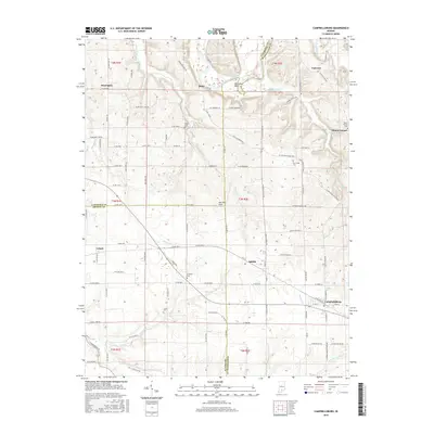
2016 Map of Campbellsburg
USGS Topo · Published 2016About this map
Campbellsburg and Saltillo anchor the southeastern corner of this map, situated where the karst topography of the Mitchell Plain meets the drainages of Carters Cr. The landscape is defined by the winding course of the East Fork White River in the north, featuring the prominent Horseshoe Bend near the settlement of Bono. This area serves as a triple junction for Lawrence, Orange, and Washington counties, with the small community of Leipsic marking the western edge near Fishing Cr. Genealogists will find several rural burial sites scattered throughout the rolling terrain, including Freedom Cem, Freed Cem, and the Mount Carmel Cem near the eastern border. The drainage patterns of Sugar Creek and Clifty Creek illustrate the dissected nature of the plateau, while the proximity of the Lost River in the south highlights the region's unique subterranean hydrology.
Find a feature on this map
111 named features on this map. Tap any name to fly to it.
Don’t see what you’re looking for? This feature index may not catch every label — zoom into the map to look around manually.
Map Details
Editions of this 2016 Campbellsburg Map
This is the sole edition of this map. No revisions or reprints were ever made.
Other maps of this area

1934 · Bedford
USGS Topo · 1:48,000

1937 · Bedford
USGS Topo · 1:62,500

1950 · Becks Mill
USGS Topo · 1:24,000

1950 · Mitchell
USGS Topo · 1:24,000

1951 · Smedley
USGS Topo · 1:24,000

1956 · Vincennes
USGS Topo · 1:250,000

1957 · Vincennes
USGS Topo · 1:250,000

1957 · Campbellsburg
USGS Topo · 1:24,000

1957 · Livonia
USGS Topo · 1:24,000
1957 · Paoli
USGS Topo · 1:24,000