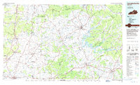
1986 Map of Campbellsville
USGS Topo · Published 1986About this map
The Green River winds through this Central Kentucky landscape, dominated by the waters of Green River Lake State Park and the prominent elevations of Muldraugh Hill. In the mid-1980s, the region around Campbellsville and Columbia-Adair County Airport reflects a mix of traditional agriculture and specialized industrial activity, evidenced by the Magnolia Gas Storage Field and an Underground Gas Storage Field.
Find a feature on this map
229 named features on this map. Tap any name to fly to it.
Don’t see what you’re looking for? This feature index may not catch every label — zoom into the map to look around manually.
Map Details
Editions of this 1986 Campbellsville Map
2 editions found
Other maps of this area

1905 · Harrodsburg
USGS Topo · 1:125,000

1911 · Monticello
USGS Topo · 1:62,500

1914 · Monticello
USGS Topo · 1:62,500

1922 · Mammoth Cave
USGS Topo · 1:62,500

1923 · Mammoth Cave
USGS Topo · 1:62,500

1925 · Cub Run
USGS Topo · 1:62,500

1926 · Scottsville
USGS Topo · 1:62,500

1932 · Big Clifty
USGS Topo · 1:62,500

1934 · Munfordville
USGS Topo · 1:48,000

1935 · Horse Cave
USGS Topo · 1:48,000