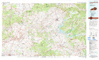
1986 Map of Campbellsville
USGS Topo · Published 1995About this map
Campbellsville and Greensburg serve as the primary hubs in this mid-1980s landscape, where the Green River carves a winding path through Central Kentucky. The creation of Green River Lake State Park has significantly altered the local geography, creating a massive water body that reshapes the terrain near Knifley and Cane Valley. This period shows a region balanced between its agricultural roots and modern infrastructure, evidenced by the Cumberland Parkway and Jackson Highway cutting across the southern reaches.
Find a feature on this map
138 named features on this map. Tap any name to fly to it.
Don’t see what you’re looking for? This feature index may not catch every label — zoom into the map to look around manually.
Map Details
Editions of this 1986 Campbellsville Map
2 editions found
Other maps of this area

1905 · Harrodsburg
USGS Topo · 1:125,000

1911 · Monticello
USGS Topo · 1:62,500

1914 · Monticello
USGS Topo · 1:62,500

1922 · Mammoth Cave
USGS Topo · 1:62,500

1923 · Mammoth Cave
USGS Topo · 1:62,500

1925 · Cub Run
USGS Topo · 1:62,500

1926 · Scottsville
USGS Topo · 1:62,500

1932 · Big Clifty
USGS Topo · 1:62,500

1934 · Munfordville
USGS Topo · 1:48,000

1935 · Horse Cave
USGS Topo · 1:48,000