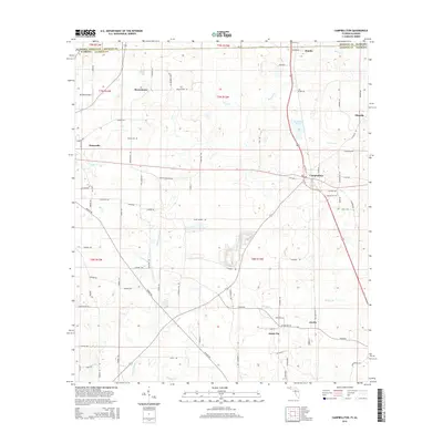
2015 Map of Campbellton
USGS Topo · Published 2015About this map
Campbellton and Graceville anchor this northern Jackson County landscape, where the Florida panhandle meets the Alabama state line. The survey captures a network of rural settlements including Jacob City, Browntown, and Rambo during a period of modern connectivity and established agricultural boundaries. Notable family and community landmarks like Hinson Cem and Gaynor Pond are documented alongside the drainage systems of Little Alligator Cr and Spring Cr. The presence of the Kirkland Airport near the western edge reflects the area's development beyond its traditional agrarian roots. This map provides a clear view of the transition from the rolling hills of Geneva and Houston County, Alabama, into the panhandle's interior, tracing local routes such as Old Hwy 2 and the Shiloh Church Loop that connect these historic communities.
Find a feature on this map
88 named features on this map. Tap any name to fly to it.
Don’t see what you’re looking for? This feature index may not catch every label — zoom into the map to look around manually.
Map Details
Editions of this 2015 Campbellton Map
This is the sole edition of this map. No revisions or reprints were ever made.
Other maps of this area

1942 · Enterprise
USGS Topo · 1:125,000

1950 · Chipley
USGS Topo · 1:24,000

1951 · Graceville
USGS Topo · 1:24,000

1951 · Chipley
USGS Topo · 1:24,000

1952 · Cottondale East
USGS Topo · 1:24,000

1952 · Campbellton
USGS Topo · 1:24,000

1952 · Cottondale West
USGS Topo · 1:24,000

1952 · Sills
USGS Topo · 1:24,000

1953 · Dothan
USGS Topo · 1:250,000

1954 · Dothan
USGS Topo · 1:250,000