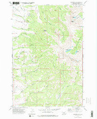
1972 Map of Campfire Lake
USGS Topo · Published 1976About this map
Gallatin National Forest dominates this high-elevation landscape, where the headwaters of numerous creeks carve through the Montana backcountry. The 1972 field survey shows a network of pack trails and jeep tracks providing the primary access to remote peaks such as Sunlight Peak and Sugarloaf Mountain. Isolated administrative outposts like the Porcupine Guard Sta and Ibex Guard Sta serve as markers of the area's forest management history. High-altitude water bodies, including Campfire Lake, Moose Lake, and the evocative Dead Horse Lakes, dot the eastern portion of the quadrangle. The intricate drainage patterns, from Horse Creek in the south to the South Fork Shields River in the north, suggest a terrain defined by seasonal runoff and steep relief, largely untouched by modern infrastructure and preserved for wilderness use.
Find a feature on this map
41 named features on this map. Tap any name to fly to it.
Don’t see what you’re looking for? This feature index may not catch every label — zoom into the map to look around manually.
Map Details
Editions of this 1972 Campfire Lake Map
2 editions found
Other maps of this area

1886 · Little Belt Mts.
USGS Topo · 1:250,000

1891 · Livingston
USGS Topo · 1:250,000

1893 · Livingston
USGS Topo · 1:250,000

1894 · Little Belt Mts.
USGS Topo · 1:250,000

1897 · Little Belt Mts.
USGS Topo · 1:250,000

1898 · Little Belt Mts.
USGS Topo · 1:250,000

1902 · Little Belt Mts.
USGS Topo · 1:250,000

1947 · Bozeman
USGS Topo · 1:250,000

1948 · Bozeman
USGS Topo · 1:250,000

1948 · White Sulphur Springs
USGS Topo · 1:250,000