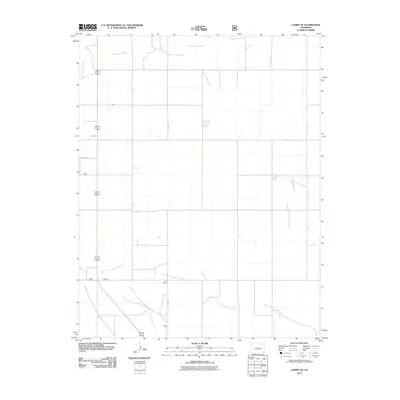
2011 Map of Campo NE
USGS Topo · Published 2011About this map
North Fork Cimarron River and Sand Arroyo Creek define the drainage patterns of this high plains landscape in the southeast corner of the state. The terrain is organized by an extensive grid of local routes, including Co Rd S, Co Rd 27, and Co Rd N, reflecting the systematic agricultural and ranching layout of Baca County. This 2011 survey illustrates the modern rural infrastructure, showing how human development is strictly aligned with the cardinal directions across the open territory. The lack of concentrated town centers emphasizes the area's character as a vast, open production landscape where life centers on the management of water and the maintenance of the county road network.
Find a feature on this map
12 named features on this map. Tap any name to fly to it.
Don’t see what you’re looking for? This feature index may not catch every label — zoom into the map to look around manually.
Map Details
Editions of this 2011 Campo NE Map
This is the sole edition of this map. No revisions or reprints were ever made.
Other maps of this area

1891 · Springfield
USGS Topo · 1:125,000

1892 · Vilas
USGS Topo · 1:125,000

1893 · Springfield
USGS Topo · 1:125,000

1955 · La Junta
USGS Topo · 1:250,000

1958 · La Junta
USGS Topo · 1:250,000

1968 · La Junta
USGS Topo · 1:250,000
1978 · Moore Draw SW
USGS Topo · 1:24,000

1978 · Springfield SW
USGS Topo · 1:24,000
1978 · Campo SW
USGS Topo · 1:24,000

1978 · Campo NE
USGS Topo · 1:24,000