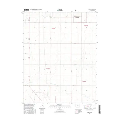
2016 Map of Campo NE
USGS Topo · Published 2016About this map
Comanche National Grassland dominates the landscape of this corner of Baca County, where the high plains terrain is defined by drainage patterns and a strict section-line road grid. The N Fork Cimarron River winds through the southern portion of the quadrangle, while the ephemeral Sand Arroyo cuts across the northwest, illustrating the delicate hydrology of this semi-arid region.
Find a feature on this map
22 named features on this map. Tap any name to fly to it.
Don’t see what you’re looking for? This feature index may not catch every label — zoom into the map to look around manually.
Map Details
Editions of this 2016 Campo NE Map
This is the sole edition of this map. No revisions or reprints were ever made.
Other maps of this area

1891 · Springfield
USGS Topo · 1:125,000

1892 · Vilas
USGS Topo · 1:125,000

1893 · Springfield
USGS Topo · 1:125,000

1955 · La Junta
USGS Topo · 1:250,000

1958 · La Junta
USGS Topo · 1:250,000

1968 · La Junta
USGS Topo · 1:250,000
1978 · Moore Draw SW
USGS Topo · 1:24,000

1978 · Springfield SW
USGS Topo · 1:24,000
1978 · Campo SW
USGS Topo · 1:24,000

1978 · Campo NE
USGS Topo · 1:24,000